Directory / Western Australia / Great Southern
Public trail
Bluff Knoll Summit Trail
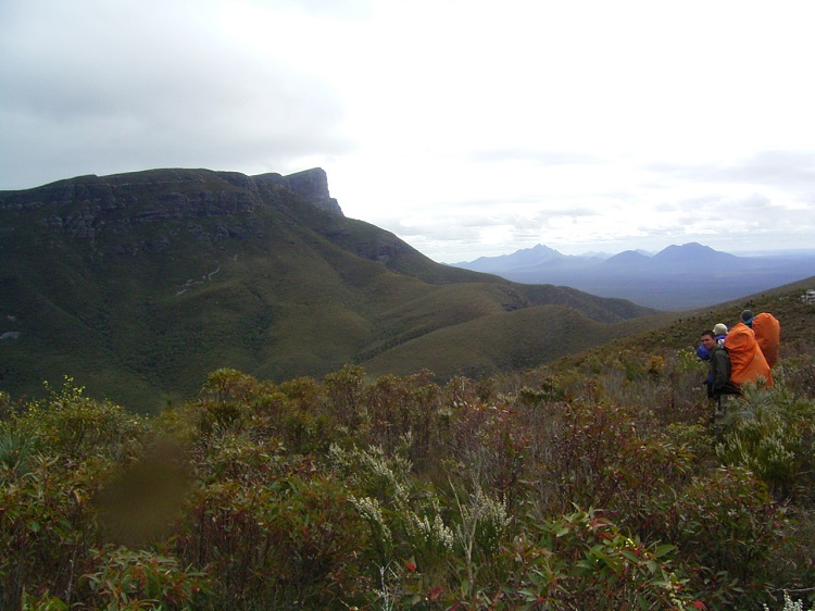
Bluff Knoll (Bular Mial / Pualaar Miial) is, at 1,098 m, the highest peak in Western Australia's south-west. It sits in the Stirling Range National Park, about an hour north of Albany. DBCA lists the summit trail as a 6.8 km return, Grade 4 walk. It climbs steeply and usually takes 3–4 hours.
Route. From the Bluff Knoll car park the trail climbs steadily on a formed track with many rock steps. It curves around the eastern side of the bluff before levelling out on the summit plateau. The views take in the jagged peaks of the Stirlings and, on clear days, the coast near Albany.
Grade. AWTGS Grade 4. The climb is short but steep and sustained.
Weather. The Stirlings make their own weather. The summit can be cloudy, windy and very cold even when the plains are warm. It's one of the few places in WA to get occasional snow. Take a warm, waterproof layer every time.
Access and fees. Stirling Range Drive and Bluff Knoll Rd are sealed. A WA national park entry pass applies. Toilets are at the car park and nearby Bluff Knoll café area, and there's camping at Moingup Springs.
Wildflowers. The range is a global biodiversity hotspot with over 1,500 plant species, many found nowhere else. Spring (September to November) is outstanding.
Best season. Autumn to spring. Avoid hot summer days and total fire ban days.
Who it suits. Bluff Knoll suits fit day walkers and is a popular training climb for longer hikes. Experienced, self-sufficient walkers can attempt the Stirling Ridge Walk, a remote multi-day off-track route rated among Australia's toughest, but only with strong navigation skills and a PLB. The peak holds deep cultural significance for the Goreng and Menang Noongar people, who know it as Bular Mial or Pualaar Miial, often translated as "many-eyed hill". Allow time for Stirling Range Drive, which passes several shorter peak walks, including Toolbrunup and Mount Trio.
Before you go
- Check the official park page for alerts, closures, fire danger ratings and planned burns on the day you walk.
- Check the Bureau of Meteorology forecast for the nearest town and the mountain or coastal district.
- Tell someone your plan and expected return time, or register your trip intention where the park offers it.
- Carry the ten essentials: water, food, map, first aid, warm and waterproof layers, sun protection, a torch, phone and power bank, an emergency shelter, and a personal locator beacon (PLB) for remote walks.
- Leave no trace: take all rubbish home, stay on the track, and respect Aboriginal cultural sites.
Facts on this page were checked against the official park agency source listed below. Conditions, fees and rules change, so always confirm before you go.
FAQ
- Is it busy? Weekends and school holidays get very busy. Start early.
- Can it snow? Occasionally, in winter. Cold wind is common at any time of year.
- Is there a lower option? Several shorter Stirling Range walks are listed on the DBCA park page.
Dogs: not permitted. Official source: https://exploreparks.dbca.wa.gov.au/park/stirling-range-national-park
At a glance
- Distance
- 6.8 km
- Duration
- Not published
- Official track grade
- Grade 4 · Advanced
- Elevation gain
- Not published
- Cost
- Park entry fees apply
- Experience
- Self-guided
- Facilities
- Toilets, picnic tables, shelters and lookouts
- Accessibility
- Wheelchair accessible lookouts and facilities at the carpark; this does not describe summit trail access.
- Dogs
- Not permitted
- Family suitability
- Not published
- Public transport
- Not published
Plan your visit
Seasonal considerations: Rapid weather changes; prepare for rain, hail and sudden cold.
Check the full official description for route variants, facilities and current access. Published information may change.
Opens official trail information. Check alerts and closures before travelling; this button does not indicate the trail is open.
More in Great Southern
For operators: claim or upgrade your listing Run this walk, guide on it, or offer accommodation or transport nearby? Claim your free listing to correct details or add your business. Want more visibility? Featured placement starts at A$29/month + GST, and every paid placement is clearly labelled Sponsored. Official track facts always come from the park agency and can't be paid for. Claim this listing · See advertising options